In recent years, a guy called Lidar has entered various fields of surveying and mapping. Many people feel very unfamiliar with it. In fact, he is an old guy. The distance between the earth and the moon as we know it is achieved through laser ranging technology. . The principle of laser ranging is very simple, that is, by measuring the time from when the laser is emitted to the time when the reflected light from the moon reaches the earth, multiplying it by the speed of light and dividing by 2, it is the distance between the earth and the moon. In order to ensure that the laser light can be well reflected back, the Americans who landed on the moon specially placed such a mirror on the moon to ensure that the laser light is well reflected back.
Human landing on the moon
With the development of GPS and IMU (inertial navigation technology), accurate real-time positioning and attitude determination are possible. Many manufacturers have found that this guy is very suitable for dry surveying and mapping, so in recent years, Lidar has been pushed to you. When someone sees lidar, a doubt will pop up in their minds:
What is the difference between lidar and radar?
Is Lidar a radar?
the answer is!
If you don't believe us, look at the picture below:
The difference between lidar and radar
The difference between them is as simple and understandable as the name. Lidar is a radar that emits laser light. The principle is basically similar, except that the lidar emits a straight beam, while the radar emits a cone-shaped electromagnetic wave beam.
According to the purpose, we can divide laser sensors into two categories, namely, obstacle avoidance level and high-precision surveying and mapping level. Through comparison, we can find that some key parameters, such as angular resolution, field of view, measurement distance, measurement rate, measurement Precision, multiple echo technology, multi-cycle echo technology, etc., these two types of laser sensors are quite different. Next, we will focus on the surveying and mapping lidar.
Surveying and mapping lidar is a system that integrates laser sensors, GNSS, IMU, and cameras. Through the parameter calibration of each sensor, the position deviation between the sensors and the rotation angle used for conversion between different coordinate systems can be accurately calculated. In this way, the relative coordinates of the acquired point cloud data are converted into geodetic coordinates. In short, you can scan as you walk, and the points you scan out are all geodetic coordinates! It's so cool!
Measurement lidar system composition
Measurement lidar system composition
When using lidar for surveying and mapping, we can generally use mobile platforms such as cars, unmanned aerial vehicles, and manned aircraft as carriers. The raw laser data, GNSS data, and IMU data in the movement can be obtained through post-processing in the post-processing mode. Centimeter-level precision POS data is based on POS and raw laser data to generate laser point cloud results that we often see.
So what are the differences between the various platforms and how to choose?
Pursue efficiency and install it directly on a helicopter or fixed-wing aircraft!
The measurement efficiency is directly full, but because the helicopter or fixed-wing flying is higher, the accuracy is worse, generally around 10CM, this method can be selected for large-area topographic surveying.
The survey area is suitable for flying, and the accuracy is required, so use a rotary-wing UAV.
The efficiency of using rotary-wing UAVs is slightly lower than that of fixed-wing UAVs, but it is more handy in terms of precision control, which can reach 5cm accuracy. Airborne lidar is a combination of panacea, which can show its skills no matter what the terrain.
For specific urban areas or street environments, select the on-board mode lidar on-board mode.
It can only scan data within 200 meters on both sides of the road, and the scanning area is limited. This mode of operation can be used in general road reconstruction and expansion projects or strip topographic map projects, and the accuracy within 100 meters is 5cm.
Backpack as a supplementary means to fill the last gap
Since we are a multi-platform lidar, we can even carry out measurements on our back. The existence of the backpack mode is to supplement the deficiencies of the above several operating methods. It is used to measure some places where cars and airplanes cannot get in, such as underground space measurement, mine measurement, square volume calculation and so on. Because there is a certain amount of artificial jitter when people are walking with the equipment on their backs, it is generally about 10cm after processing.
In recent years, a guy called Lidar has entered various fields of surveying and mapping. Many people feel very unfamiliar with it. In fact, he is an old guy. The distance between the earth and the moon as we know it is achieved through laser ranging technology. . The principle of laser ranging is very simple, that is, by measuring the time from when the laser is emitted to the time when the reflected light from the moon reaches the earth, multiplying it by the speed of light and dividing by 2, it is the distance between the earth and the moon. In order to ensure that the laser light can be well reflected back, the Americans who landed on the moon specially placed such a mirror on the moon to ensure that the laser light is well reflected back.
With the development of GPS and IMU (inertial navigation technology), accurate real-time positioning and attitude determination are possible. Many manufacturers have found that this guy is very suitable for dry surveying and mapping, so in recent years, Lidar has been pushed to you. When someone sees lidar, a doubt will pop up in their minds:
What is the difference between lidar and radar?
Is Lidar a radar?
The difference between lidar and radar
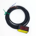
The difference between them is as simple and easy to understand as the name. Lidar is a radar that emits laser, such as the TOF-05D series of CYNDAR. The principle is basically similar, except that the lidar emits a straight beam, while the radar emits a cone-shaped electromagnetic wave beam.
According to the purpose, we can divide laser sensors into two categories, namely, obstacle avoidance level and high-precision surveying and mapping level. Through comparison, we can find that some key parameters, such as angular resolution, field of view, measurement distance, measurement rate, measurement Precision, multiple echo technology, multi-cycle echo technology, etc., these two types of laser sensors are quite different. Next, we will focus on the surveying and mapping lidar.
Surveying and mapping lidar is a system that integrates laser sensors, GNSS, IMU, and cameras. Through the parameter calibration of each sensor, the position deviation between the sensors and the rotation angle used for conversion between different coordinate systems can be accurately calculated. In this way, the relative coordinates of the acquired point cloud data are converted into geodetic coordinates. In short, you can scan as you walk, and the points you scan out are all geodetic coordinates! It's so cool!
When using lidar for surveying and mapping, we can generally use mobile platforms such as cars, unmanned aerial vehicles, and manned aircraft as carriers. The raw laser data, GNSS data, and IMU data in the movement can be obtained through post-processing in the post-processing mode. Centimeter-level precision POS data is based on POS and raw laser data to generate laser point cloud results that we often see.
So what are the differences between the various platforms and how to choose?
Pursue efficiency and install it directly on a helicopter or fixed-wing aircraft!
The measurement efficiency is directly full, but because the helicopter or fixed-wing flying is higher, the accuracy is worse, generally around 10CM, this method can be selected for large-area topographic surveying.
The survey area is suitable for flying, and the accuracy is required, so use a rotary-wing UAV.
The efficiency of using rotary-wing UAVs is slightly lower than that of fixed-wing UAVs, but it is more handy in terms of precision control, which can reach 5cm accuracy. Airborne lidar is a combination of panacea, which can show its skills no matter what the terrain.
UAV airborne radar, airborne Lidar
Rotor drone operation mode
For specific urban areas or street environments, select the on-board mode lidar on-board mode.
It can only scan data within 200 meters on both sides of the road, and the scanning area is limited. This mode of operation can be used in general road reconstruction and expansion projects or strip topographic map projects, and the accuracy within 100 meters is 5cm.
Backpack as a supplementary means to fill the last gap
Since we are a multi-platform lidar, we can even carry out measurements on our back. The existence of the backpack mode is to supplement the deficiencies of the above several operating methods. It is used to measure some places where cars and airplanes cannot get in, such as underground space measurement, mine measurement, square volume calculation and so on. Because there is a certain amount of artificial jitter when people are walking with the equipment on their backs, it is generally about 10cm after processing.
With so many parameters of lidar, what indicators should I pay attention to?
1. Angular resolution, which is the accuracy of angle measurement
Angular resolution is the ability of the scanner to distinguish the target. The smaller the angular resolution, the smaller the target can be distinguished, and the more delicate the measured point cloud data. Generally, the angle measurement accuracy of obstacle avoidance laser sensors is only about 0.1°, while the angular resolution of surveying and mapping laser sensors is generally 0.001° or even lower.
2. Measuring distance
The measurement distance is related to the laser emission frequency and the reflectivity of actual ground objects. The maximum measurement distance is related to the reflectivity. Generally, it refers to the maximum scanning distance under the condition of ρ≧60% (partially even to ρ≧90%). The laser emission frequency is inversely proportional. The larger the emission frequency, the smaller the measurement distance. Different objects (mountains, vegetation, cement buildings, metal pipes, soil minerals, coal, etc.) have different reflectivity, and most buildings have reflectivity. About 50%, coal and asphalt pavement is about 20%, so in practical applications, we have to discount the maximum range of the equipment.
3. Measuring speed
It is generally reflected by the maximum emission frequency of the laser pulse. For example, the maximum laser emission frequency of RIEGL's VUX-1UAV is 550,000 points/sec, while the mini VUX-1UAV is 100,000 points/sec.
4. Measurement accuracy
It refers to the true value obtained after measuring a certain amount. It is the degree of consistency with the truth. Repeatability is also called reproducibility or repeatability, which is a quantity used to express the possibility of obtaining the same result from multiple measurements. Generally, the measurement accuracy of laser sensors of surveying and mapping level is about 1cm.
5. Field of view
The field of view = the scanning angle of the laser beam, which refers to the maximum angle range that the laser beam can reach through the scanning device, and the effective field of view is generally related to the altitude and effective measurement distance during actual operation. Although the horizontal field of view of many laser sensors is 360°, we generally only use 90°-120° in actual applications.
The benefits have been said so much, so what are the shortcomings of lidar?
1. Affected by weather and environment.
Regardless of the working mode of lidar, due to the limitation of the physical characteristics of the laser, the laser sensor is greatly affected by environmental factors, and it is not stable and reliable outdoors and in the environment of smoke, dust, rain, snow, sand and strong light. To work.
2. Expensive
The price of industrial products is rational, and its research and development costs are high, and this can only be diluted by mass production. At this stage, the demand for lidar is not so large, which makes it difficult to reduce the cost. The other is the marginal cost. Lidar is a high-precision machine. The laser head that can be used for surveying and mapping is much more expensive than the obstacle avoidance level. Product production is not easy, and the production cost itself is very high.
Although the current lidar is not perfect, because of its ability to transmit vegetation, it can directly measure the ground surface and solve the problem of dense forest measurement well, so it is favored by many customers. In the future, with the advancement of technology and the increase in mass production, the problem of excessive cost can be effectively reduced. Although Lidar is not perfect at present, it can be expected in the future!
With so many parameters of lidar, what indicators should I pay attention to?
1. Angular resolution, which is the accuracy of angle measurement
Angular resolution is the ability of the scanner to distinguish the target. The smaller the angular resolution, the smaller the target can be distinguished, and the more delicate the measured point cloud data. Generally, the angle measurement accuracy of obstacle avoidance laser sensors is only about 0.1°, while the angular resolution of surveying and mapping laser sensors is generally 0.001° or even lower.
2. Measuring distance
The measurement distance is related to the laser emission frequency and the reflectivity of actual ground objects. The maximum measurement distance is related to the reflectivity. Generally, it refers to the maximum scanning distance under the condition of ρ≧60% (partially even to ρ≧90%). The laser emission frequency is inversely proportional. The larger the emission frequency, the smaller the measurement distance. Different objects (mountains, vegetation, cement buildings, metal pipes, soil minerals, coal, etc.) have different reflectivity, and most buildings have reflectivity. About 50%, coal and asphalt pavement is about 20%, so in practical applications, we have to discount the maximum range of the equipment.
3. Measuring speed
It is generally reflected by the maximum emission frequency of the laser pulse. For example, the maximum laser emission frequency of RIEGL's VUX-1UAV is 550,000 points/sec, while the mini VUX-1UAV is 100,000 points/sec.
4. Measurement accuracy
It refers to the true value obtained after measuring a certain amount. It is the degree of consistency with the truth. Repeatability is also called reproducibility or repeatability, which is a quantity used to express the possibility of obtaining the same result from multiple measurements. Generally, the measurement accuracy of laser sensors of surveying and mapping level is about 1cm.
5. Field of view
The field of view = the scanning angle of the laser beam, which refers to the maximum angle range that the laser beam can reach through the scanning device, and the effective field of view is generally related to the altitude and effective measurement distance during actual operation. Although the horizontal field of view of many laser sensors is 360°, we generally only use 90°-120° in actual applications.
The benefits have been said so much, so what are the shortcomings of lidar?
1. Affected by weather and environment.
Regardless of the working mode of lidar, due to the limitation of the physical characteristics of the laser, the laser sensor is greatly affected by environmental factors, and it is not stable and reliable outdoors and in the environment of smoke, dust, rain, snow, sand and strong light. To work.
2. Expensive
The price of industrial products is rational, and its research and development costs are high, and this can only be diluted by mass production. At this stage, the demand for lidar is not so large, which makes it difficult to reduce the cost. The other is the marginal cost. Lidar is a high-precision machine. The laser head that can be used for surveying and mapping is much more expensive than the obstacle avoidance level. Product production is not easy, and the production cost itself is very high.
Although the current lidar is not perfect, because of its ability to transmit vegetation, it can directly measure the ground surface and solve the problem of dense forest measurement well, so it is favored by many customers. In the future, with the advancement of technology and the increase in mass production, the problem of excessive cost can be effectively reduced. Although Lidar is not perfect at present, it can be expected in the future!